|
|


|
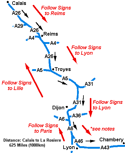
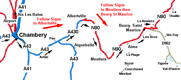
La Rosiere Access Map |
|
General: This is the usual route people use to get to La Rosiere. The driving time is approximately 10 hours. The majority of the journey is normally quite quick, however the last step of the journey ,up the mountain from Bourg St Maurice can be slowr. *note: before you get to Lyon, take the right turning (A46) Signed "Marseilles Geneva Grenoble Lyon-Est" (it does not say Chambery). Continue on for quite a few miles following the signs for "Marseilles Grenoble Lyon" until you get to a Chambery signs then continue onto Chambery. You will have to stay alert - you will change motorways frequently. Stop Overs: Depending on how far you have driven to get to Calais, you may find Dijon or Chambery a good places to stop for the night. Boulogne: From Boulogne - follow the signs to St Omer (N42). Just before reaching St Omer you get onto the A26 to Reims. On your return it is signposted Boulogne. Note: the journey distance is about the same as that from Calais. |
|
|
|
|
|
| Home
| Contact: clare@La Rosiere.co.uk
[ |
 ]
]